
It served as the primary stronghold in the capital of the Second Bulgarian empire. It’s situated on the Yantra river, on a hill of the same name, across it is the other main hill in the medieval city - Trapezitsa.
It was conquered on 17 July 1393 by the ottomans after a three month siege, during which the tsar was at Nikopol, leaving the Bulgarian patriarch to defend the city.
On 22 September 1908, at the foot of Tsarevets, in the Holy Forty martyrs church, tsar Ferdinand declares Bulgaria’s independence from the Ottoman Empire.
You must log in or register to comment.
Here’s a map of medieval Turnovo
Here’s a map of medieval Turnovo, showing the city’s planning.
The city is absolutely packed with history and full of things to see and do. Would definitely recommend a visit!
“Rock of Execution”…I’m sure that’s just where they executed well thought-out plans, right?
Was just gonna write about it to your other comment lol. Yep, that’s the place, one of those plans was Joachim III, the then patriach of Bulgaria until 1300…
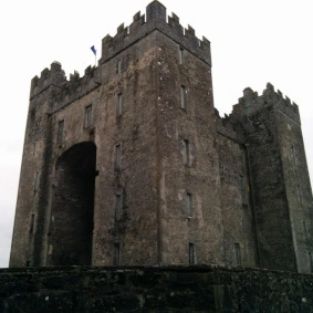
Now this is a fortress. I especially love how existing rock is incorporated into the whole thing, like here:

Thanks for posting!
Thanks!
The city’s location is amazing when it comes to defence - on a steep hill, surrounded by a river from almost all sides.
