- cross-posted to:
- [email protected]
cross-posted from: https://hobbit.world/post/7613
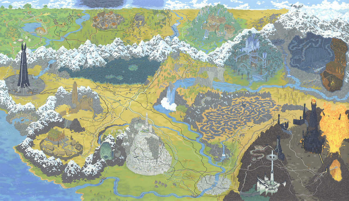
This is a wonderful stylized version of the Middle Earth map which shows the path of the ring, although you need to zoom in to see all those lines. The orientation of things is kind of all over the place, but that was obviously done in order to fit all the different places into a single image. I wouldn’t use it to actually travel in Middle Earth, but it looks amazing.
Minas Tirith and Mordor are positioned side by side like normal in the front, but behind we actually see things going westward with Isengaard in the middle left. Then Hobbiton, Bree, Weathertop, Rivendell, Lorien, and Moria along the top left to right. I won’t list every place in there, but they managed to cram practically everything in there.
I wanted to link to the gif of the making of this image, but Lemmy didn’t like it. But, I strongly recommend checking it out. I love seeing the stages of art being made.
Also, check out all the details about this image by Andrew DeGraff. It shows lots of detail about different parts of this image.